A Comprehensive West Coast Trail Guide
The West Coast Trail is an iconic hike that follows part of the west coast of Vancouver Island. It is part of the Pacific Rim National park and is considered a complex and challenging trail. Before hitting the trail, each hiker needs to watch an online video and attend an in-person orientation with Parks Canada to get up to date tide tables and ensure adequate preparedness.

Stats and Information:
75km long (but actual hiked miles is longer)
1300-1900m elevation gain/loss
Typically takes 5-7 days to complete
Season - May 1st - October 7th
Entry and exit points: Pachena Bay (north), Balaats’adt (Nitinaht Village) (mid-point), and Gordon River (south).
Interesting facts:
The West Coast Trail traces routes that have been traveled for centuries. The Huu-ay-aht, Ditidaht, and Pacheedaht Nations established villages and seasonal camps along these paths and paddling routes, using them for trade and connection long before foreign vessels appeared on the horizon more than 200 years ago.
There are more than 100 ladders on the trail, sometimes slippery and very high
Wildlife viewing opportunities are amazing, including gray whales, humpback whales, orcas, sea lions, harbor seals, black bears, wolves, cougars, and bald eagles. When I hiked in June 2019 we saw sea lions, eagles, a gray whale and bear scat and prints.
Some parts of the trail are only accessible when the tides are low enough, which requires pre-planning to make sure you don’t get stuck. If you can time your hiking to be able to hike to Owen Point (gorgeous sea caves only accessible at tides less than 1.8m), I highly recommend it!

Permits
Permits will be released by Parks Canada on February 5th, 2026 at 8:00 AM PT. The approximate cost is $264.50 per person, plus an $11.50 booking fee per reservation. In addition to the West Coast Trail permit, all visitors to Pacific Rim National Park Reserve are required to have a valid National Park Entry Pass.
Tips for Successfully Securing Your Permits
Get comfortable with the Parks Canada reservation system ahead of time and know exactly where to find the WCT permit (Backcountry → West Coast Trail)
Create your account and log in more than 30 minutes before the permits go live
Have multiple devices and use different browsers (Chrome, Safari etc) as each of them will be able to join the queue separately - gives you more options for a better spot in the queue
Don’t panic and keep trying for at least 30+ minutes even if it looks like everything has sold out - permits time out of peoples carts if they don’t finish the check out process, and are then released back into the booking system
Sign up to Schnerp or CampNab for cancellations if you aren’t successful on release day
Planning your Itinerary
Your most important decision (other than your start date) is if you’re going North to South or South to North.

North to South (Pachena Bay to Gordon River):
Pros: start off with easier terrain to get used to hiking with your backpack, save the best but hardest parts until the end of the hike when your pack is lightest
Cons: You know the hardest part of the trail is still to come for most of the trip, and you may be physically quite tired by that point
South to North (Gordon River to Pachena Bay):
Pros: get the hardest part out of the way first so you can cruise the rest of the trail, especially if you're in great shape or like mentally knowing that hardest part is done early
Cons: you're doing the hardest terrain with the heaviest backpack
Another thing that can help you decide is to consider your travel logistics to get to the start of the trail and once you finish. This may make the choice clear which works better for your schedule.
When I hiked in 2019, the timing worked out well for us to drive to Gordon River, do the afternoon orientation and spend the night, get the bus to Pachena Bay the next morning and still be able to hike 14km to Darling River that afternoon. This will also be our plan for 2026.
In your itinerary you should also plan approximately how long you want to spend on the trail. Parks Canada allows up to 14 days to complete the trail, but most people choose an itinerary between 5-7 days. Have a plan for which campsites you want to camp at based on your ideal daily mileage - you don’t have to pre-book each site, but this will help build your itinerary.

Campsites along the WCT
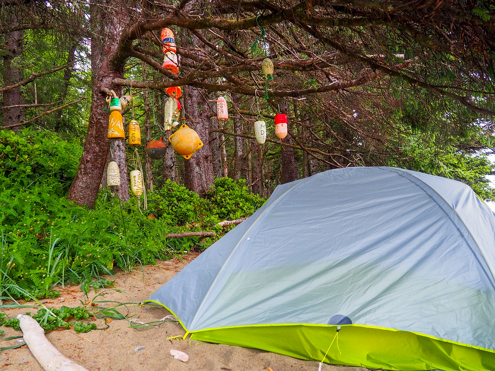
You can technically camp anywhere along the WCT (aside from km 34-38 due to wildlife), but these are the established campgrounds with bear bins and outhouses (listed N to S):
Michigan Creek (12km)
Darling River (14km)
Orange Juice Creek (15km) - no infrastructure
Tsocowis Creek (17km)
Klanawa Creek (23km)
Tsusiat Falls (25km) - most popular campsite along the WCT
Cribs Creek (42km)
Carmanah Creek (46km)
Bonilla Point (48km)
Walbran Creek (53km)
Cullite Cove (58km)
Camper Bay (62km)
Thrasher Cove (70km)
There are also paid cabin options at Nitinaht Narrows (32.5km) near the Crab Shack.
Transport to and from the trail
Unless you already live on Vancouver Island, you’ll need to either fly or take BC Ferries to Nanaimo or Schwartz Bay. I then recommend driving to the end you’re going to finish the trail, and then taking the West Coast Trail Express bus to the start. This way you can finish right at your vehicle rather than having to sit on a bus for 4 hours dirty and stinky after hiking for a week.
Pro tip: have some clean, cosy clothes and your favourite snacks ready in your vehicle for when you finish - you’ll be so grateful for this after a week in the backcountry!
The WCT Express Bus also has stops in Nanaimo and Victoria if you want to fully bus there rather than drive to either trailhead.
It’s also possible to take a boat from Port Alberni to Bamfield, via a service offered by Lady Rose Marine. Some people have also chartered seaplanes to start/end their trip.

Gear
The WCT can be soggy no matter when you hike it! Aside from the normal backpacking gear list, here are some other items I recommend:
Gaiters - there are lots of sandy and muddy areas and this will stop it getting all in your shoes
Rain gear (jacket at least, pants and a tarp if it’s going to be a wet week)
Entertainment - you may have some relaxing evenings at camp, so having a book or cards to play can be highly enjoyable while sitting on the beach
Firestarter - unless there is a fire ban, you can have campfires on the beach and having something you can easily start fires with makes a big difference
Try to keep your pack as light as you can while still having everything needed for safety. The lighted your pack, the easier the hiking will feel and the less fatigued your body will get over the 5+ days on trail.

Food
Food is honestly one of my favourite parts of backpacking. There's nothing better than being able to eat food that tastes incredible because you've worked hard for it, all while sitting somewhere beautiful in nature.
For the WCT, carrying food for 5-7 days can be heavy. Be sure to pack enough food for each day of your hike, plus some buffer in case you’re hungrier than expected or if you end up taking longer than planned. Make sure the food you pack is stuff you’ll actually want to eat, otherwise you’ll have to pack it out (which keeps your pack heavier than it needs to be). Electrolytes also make a big difference if you’re sweating a lot and hiking for long hours each day.
When packing food for multi-day trips, I like to have each day organized in separate ziplock bags with breakfast, lunch, dinner and snacks for that day. That way you can just pull out a ziplock and put it somewhere easily accessible for you to grab throughout the day, while the rest of your food is buried in your backpack away from the sun.
Don't forget to plan for a stop at the Crab Shack for delicious fresh caught seafood, baked potatoes and drinks. This was such a treat while in the backcountry for a week. On most itineraries you'll hit the Crab Shack on day 3 (N to S) or Day 5 (S to N).

More Resources:
While this blog post is a great starting point, I highly recommend you check out the following resources for more information:
Book - Blisters and Bliss by Wayne Aitkin. Considered by many to be the bible for hiking the West Coast Trail
If you want help planning your West Coast Trail experience, drop me a line for personalized support. If this guide helped you, save it for later, share it with your hiking crew, or drop a comment below with any questions. I'd love to hear about your experience when you tackle the trail. Happy Trails!


Comments